
Desert Willow Park
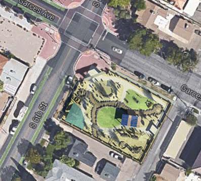
This image is a Photoshop rendering of what the park would look like from an aerial perspective if it were actually built on the site. In order to create this image, I took a three dimensional Revit rendering so that it included shadows and overlay it on top of a google image of the Garces site. This helped to give a general idea of how the park would be situated with the surroundings and how it might react with the neighborhood.


Comments
It's great to see the overview like this, and I especially appreciate the view with the shadows turned on. I only wish it was larger so that I could see more details.